APPENDIX CTopology Data Model in Oracle
In the preceding chapters, we described how to store and perform analysis on SDO_GEOMETRY data in an Oracle database. In most cases, these geometries represent different spatial features such as roads, rivers, land parcels, city boundaries, property boundaries, and business locations. These features can be stored as columns in one or more tables in Oracle. For instance, an application may store land parcels and rivers that share edges as different features in different tables. Figure C-1 shows an example of this. Figure C-2 shows an example of what happens if a shared edge e is updated.
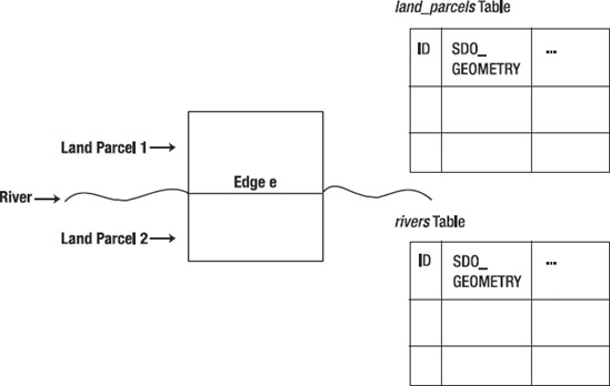
Figure C-1. ...
Get Pro Oracle Spatial for Oracle Database 11g now with the O’Reilly learning platform.
O’Reilly members experience books, live events, courses curated by job role, and more from O’Reilly and nearly 200 top publishers.

