Geodatabases—Feature Shape
The concept that a row in a table contains the attribute values of a single feature remains the same, but geodatabases allow great variety in what constitutes a feature. Specifically, geodatabases allow multipoints, multipart lines, and multipart polygons.
Points
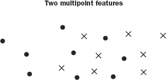
In storing point features, geodatabases allow “multipoints.” A multipoint is a collection of points associated with only a single row in the database, so all the attribute values in that row apply to all the points. An ecologist may have mapped gopher holes in an area. The only recorded difference between them is location. So, they may be stored together as a single feature. See Figure 4-8 which shows two features—one multipoint feature depicted with dots and another shown with x’s.
FIGURE 4-8 Two multipoint features: one dots, the other x’s
Lines
Linear features are represented by polylines. A polyline is composed of one path or several paths. A path is composed of sequentially connected segments that may be straight lines, but also geometric curves. You may use a portion of a circle or an ellipse (which are, mathematically, the plots of second-order equations), or you may use a type of spline, called a third-order Bézier curve. The path is a sequence of segments, and it has a left side and a right side. If a polyline is a multipart polyline, then the paths that compose it may be connected, ...
Get Introducing Geographic Information Systems with ArcGIS: A Workbook Approach to Learning GIS, 3rd Edition now with the O’Reilly learning platform.
O’Reilly members experience books, live events, courses curated by job role, and more from O’Reilly and nearly 200 top publishers.

