Unlike most other sports, baseball fields are not uniform. Old parks like Fenway Park, Wrigley Field, and Yankee Stadium have short outfield walls and kinky corners where balls get lost. Here’s an easy way to get an aerial view.
The easiest way to look at stadiums is through Google Maps (http://maps.google.com). To find a stadium, search by the name of the ballpark inside the city. For example, search for “SBC Park, San Francisco, CA” to find the ballpark where the San Francisco Giants play. Click the Satellite button in the top corner of the map and zoom in to take a closer look at the ballpark. Figure 1-17 shows the results.
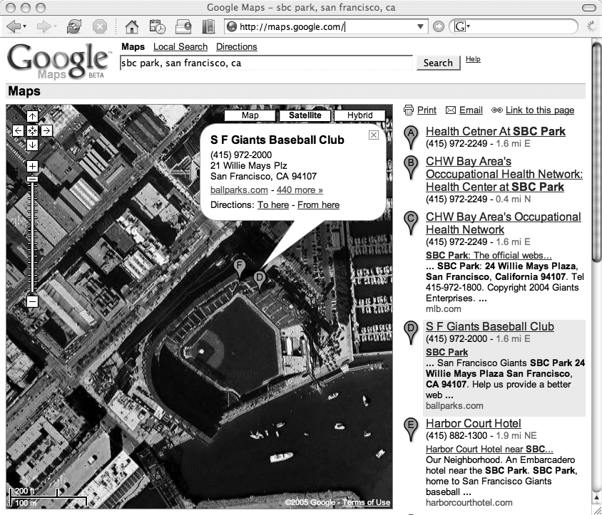
Google Maps will try to find the address and will return a list of possibilities. Sometimes the first link will be correct, but sometimes you’ll have to check other items on the list. (For example, “Petco Park, San Diego, CA” doesn’t return the right result at the top.)
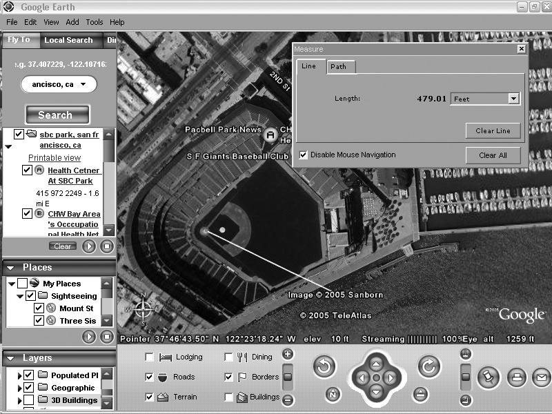
Google has released a cool new service called Google Earth that extends the aerial views of Google Maps with better images and lots of additional features. You can download a free version from http://earth.google.com. My favorite trick with Google Earth is to measure distances inside ballparks. Curious how far a home run ball was hit? Check it out with Google Earth.
For example, at SBC Park in San Francisco, Barry Bonds often hit balls out of the ballpark into McCovey Cove. How far did he actually have to hit the balls for them to reach the water? Figure 1-18 illustrates how to calculate this using Google Earth.
Here’s how to find out:
Search for the ballpark by typing sbc park, san francisco, ca into the search box and clicking the Search button.
On the results list, click SF Giants Baseball Club to zoom to this location.
Using the zoom controls under the image (the slider with the + and − buttons), zoom into the stadium until it fills the screen.
If you have 3D Buildings enabled, you’ll probably want to turn them off. This feature is cool, but it will get in your way. Under the Layers list (in the bottom-left corner), make sure 3D Buildings is not selected.
Select Measure from the Tools menu. A window will pop up. Select “feet” as the measurement.
Click on home plate and drag a line out to the water. You’ll see that the “measure” palette will record the distance as you move the line, allowing you to estimate distances. As shown in Figure 1-18, any fly ball hit more than 475 feet to right field will probably end up in McCovey Cove.
Get Baseball Hacks now with the O’Reilly learning platform.
O’Reilly members experience books, live events, courses curated by job role, and more from O’Reilly and nearly 200 top publishers.

