Importing custom geocoding
While Tableau can map most geographic locations, you may still encounter locations that are unrecognizable in Tableau, and therefore do not show up on your map. It is still possible to visualize this. One way to make this happen is by importing your location information along with its latitude and longitude coordinates into Tableau.
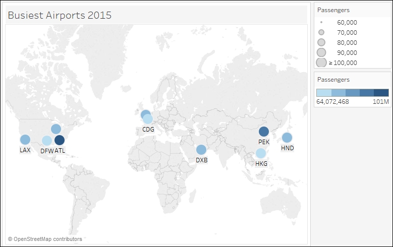
In this recipe, we will import custom geocoding to visualize where the busiest airports were in 2015:
Getting ready
To follow this recipe, open B05527_05 – STARTER.twbx. Use the worksheet called Import Geocoding, and connect to the Busiest Airports data source:
In addition, take the file called ...
Get Tableau 10 Business Intelligence Cookbook now with the O’Reilly learning platform.
O’Reilly members experience books, live events, courses curated by job role, and more from O’Reilly and nearly 200 top publishers.

