Chapter 14
All Over the Map
IN THIS CHAPTER
![]() Using geographic data
Using geographic data
![]() Mapping a state
Mapping a state
![]() Mapping the country
Mapping the country
As you might have gathered from glancing at this book’s table of contents, one of R’s major calling cards is its emphasis on visualization. Beginning with plots of analytic results, R’s graphics capabilities have evolved into map development.
R graphics honchos have created several ways of drawing maps. In this chapter, I show you the one that I think is the most straightforward and will get you on the road to Rtography. (See what I did there?)
Project: The Airports of Wisconsin
The map I show you how to draw in this project appears in Figure 14-1. It shows the locations of the major airports in Wisconsin, and includes the cities they serve, the FAA abbreviations, and the number of enplanements (commercial passenger boardings) in 2013.
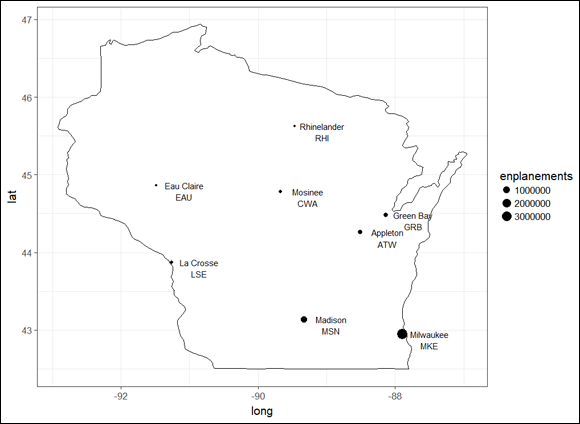
FIGURE 14-1: The major airports of Wisconsin.
Dispensing with the preliminaries
This project requires a package called maps that enables you to draw all kinds of geographic representations. Another necessary package is ggmap, which enables you to ...
Get R Projects For Dummies now with the O’Reilly learning platform.
O’Reilly members experience books, live events, courses curated by job role, and more from O’Reilly and nearly 200 top publishers.

