Chapter 7. Mapping
WHAT'S IN THIS CHAPTER?
Understanding CoreLocation and MapKit
Using Location Services
Adding maps and geocoding to your application
The display of location-specific information including maps, addresses, and points of interest is a natural feature for mobile devices such as the iPhone and iPod Touch. Outside of some niche markets it has never had great success on the desktop, primarily because the desktop PC is often stuck in a single location. Mobile devices, on the other hand, are naturally going to be carried around wherever the user goes; and as GPS technology has become smaller and cheaper it has found its way into the cell phone market.
When the iPhone first appeared its Maps application (shown in Figure 7-1) was one of the key selling features — a perfect example of the iPhone's multitouch user interface. No other mobile device had previously made navigating maps as elegant as the pinch-to-zoom, swipe-to-pan operation of Maps on the iPhone's large screen. This chapter shows you how to incorporate that same user experience into your own MonoTouch applications.
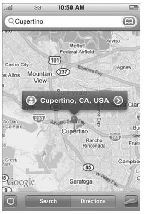
Figure 7-1. FIGURE 7-1
MAP BASICS
Before you start looking at the mapping capabilities of iPhone OS and MonoTouch, here are some mapping terms that are used throughout this chapter:
Latitude: The Y value of a location (90 to −90 degrees north to south).
Longitude: The X value of a location (180 to −180 degrees ...
Get Professional iPhone® Programming with MonoTouch and .NET/C# now with the O’Reilly learning platform.
O’Reilly members experience books, live events, courses curated by job role, and more from O’Reilly and nearly 200 top publishers.

