The metadata or ephemeris we have for the flight includes the bearing, pitch, and roll of the UAS, in addition to its elevation and location:
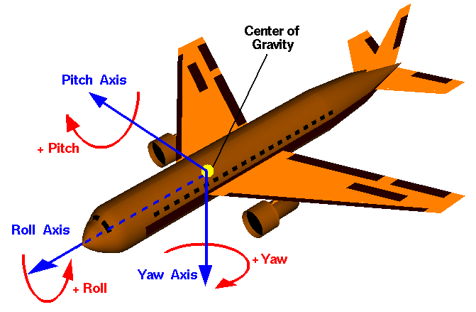
To translate these ephemeris into PostGIS terms, we'll assume the following:
- 90 degrees minus the pitch is equivalent to ST_RotateX
- The negative roll is equivalent to ST_RotateY
- 90 degrees minus the bearing is equivalent to ST_RotateZ
In order to perform our analysis, we require external functions. These functions can be downloaded from https://github.com/smathermather/postgis-etc/tree/master/3D.
We will use patched versions of ST_RotateX, ST_RotateY (ST_RotateX.sql, and ST_RotateY.sql ...

