Spatial Data Support in SSMS
When querying spatial data in SSMS, you’ll find that SSMS has a built-in capability to plot and display some basic maps of your spatial data.
To demonstrate this, you can run the following query in the AdventureWorks2008R2 or AdventureWorks2008 database in SSMS:
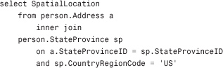
After the query runs, you should see a Spatial Results tab next to the Results tab (see Figure 42.3). Click on this tab, and the location points are plotted on a map. Select the Bonne Projection. If you look closely, you can see that the geographical points plotted roughly provide an outline of the United States. If you mouse over one of the points, SSMS displays ...
Get Microsoft® SQL Server 2008 R2 Unleashed now with the O’Reilly learning platform.
O’Reilly members experience books, live events, courses curated by job role, and more from O’Reilly and nearly 200 top publishers.

