Creating spatial indices
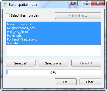
Large data layers with hundreds or thousands of features will render much more quickly with a spatial index. A spatial index is a separate file ending with a .qix extension. To create a spatial index, choose the Create Spatial Index tool by navigating to Vector | Data Management Tools. Select the loaded canvas layers or check the Select files from disk option and navigate to a folder and select layers on disk. Click on OK to create the spatial indexes:
Get Mastering QGIS - Second Edition now with the O’Reilly learning platform.
O’Reilly members experience books, live events, courses curated by job role, and more from O’Reilly and nearly 200 top publishers.

