Downloading map and elevation images
We'll download the OSM base map first, which has streets and labels:
# Download the OSM basemap
log.info("Downloading basemap")
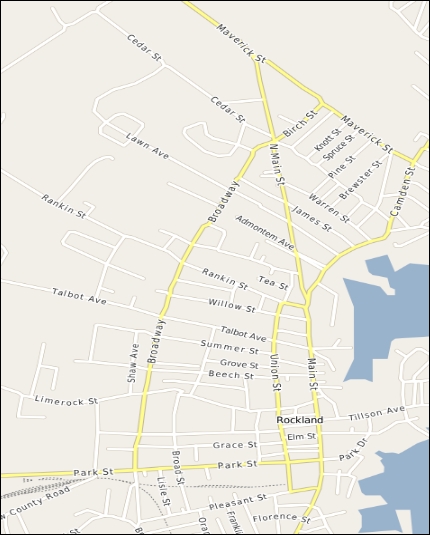
wms(mminx, mminy, mmaxx, mmaxy, osm_WMS, osm_lyr, osm_epsg, osm_style, osm_img, w, h)This section will produce an intermediate image, as shown in the following screenshot:
Next, we'll download some elevation data from the SRTM dataset. SRTM is nearly-global and provides a 30-90 m resolution. The Python SRTM.py module makes working with this data easy. SRTM.py downloads the datasets that it needs to make a request. So if you download data from different areas, you may need to clean out ...
Get Learning Geospatial Analysis with Python - Second Edition now with the O’Reilly learning platform.
O’Reilly members experience books, live events, courses curated by job role, and more from O’Reilly and nearly 200 top publishers.

