Classifying images
Automated Remote Sensing (ARS) is rarely ever done in the visible spectrum. The most commonly available wavelengths outside of the visible spectrum are infrared and near-infrared. The following scene is a thermal image (band 10) from a fairly recent Landsat 8 flyover of the US Gulf Coast from New Orleans, Louisiana to Mobile, Alabama. Major natural features in the image are labeled so you can orient yourself:
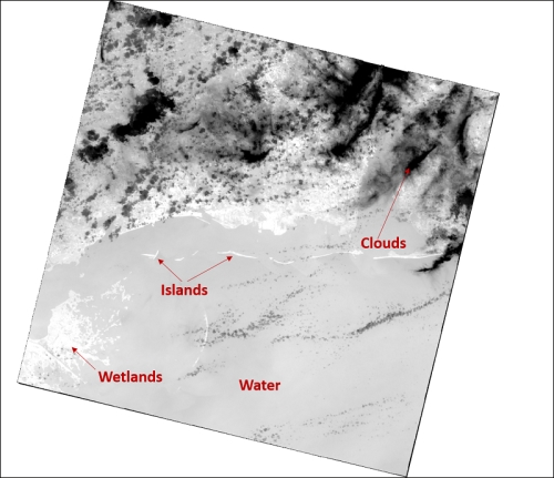
Because every pixel in that image has a reflectance value, it is information. Python can "see" those values and pick out features the same way we intuitively do by grouping related pixel values. We can colorize pixels based ...
Get Learning Geospatial Analysis with Python now with the O’Reilly learning platform.
O’Reilly members experience books, live events, courses curated by job role, and more from O’Reilly and nearly 200 top publishers.

