Clipping images
Very rarely is an analyst interested in an entire satellite scene, which can easily cover hundreds of square miles. And given the size of satellite data we are highly motivated to reduce the size of an image to only our area of interest. The best way to accomplish this reduction is to clip an image to a boundary which defines our study area. We can use shapefiles (or other vector data) as our boundary definition and basically get rid of all the data outside that boundary. The following image contains our stretched.tif image with a county boundary file layered on top, visualized in Quantum GIS (QGIS):
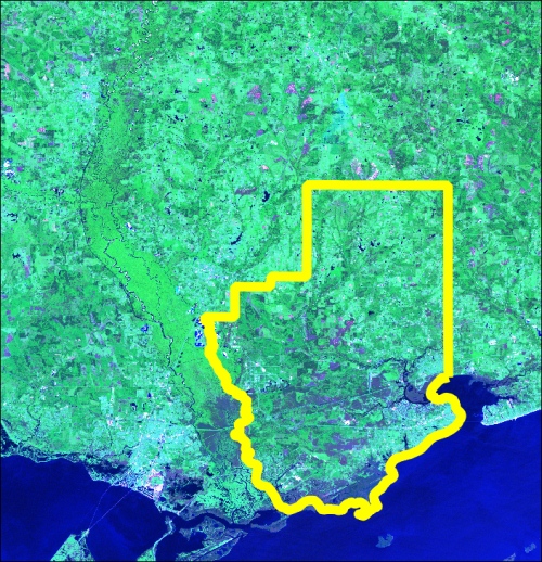
In order to clip the image, our ...
Get Learning Geospatial Analysis with Python now with the O’Reilly learning platform.
O’Reilly members experience books, live events, courses curated by job role, and more from O’Reilly and nearly 200 top publishers.

