Chapter 16
Creating Maps
Using Map Functions
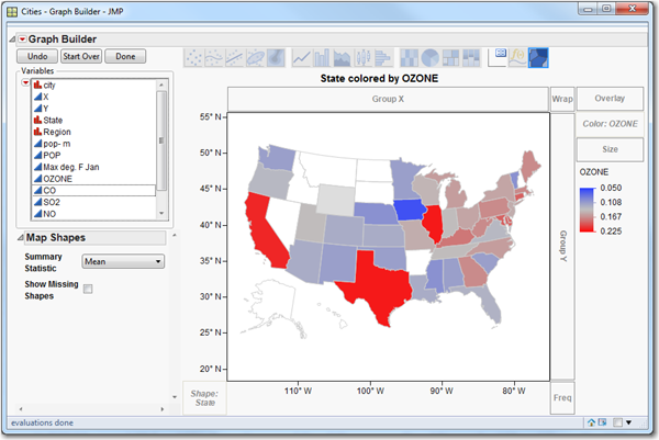
JMP transforms numbers and geographic data into compelling images, and turns simple tables of numbers into captivating pictures that bring the story in your data to life. JMP can help you display your data on geographical maps. Choose from built-in high-quality images, or use a Web Map Service to get custom map images from the Internet. JMP includes shape files for borders or many geographic regions and lets you add your own custom shapes, such as for a manufacturing plant or campus.
Figure 16.1 Example of a Map
Get JMP 10 Basic Analysis and Graphing, Second Edition now with the O’Reilly learning platform.
O’Reilly members experience books, live events, courses curated by job role, and more from O’Reilly and nearly 200 top publishers.

