County Boundaries and Polygons
____ 38. Click the Add Data button on the Standard toolbar. In the Add Data window, find (yet another instance of) the Connect To Folder icon and press it. Use the Connect To Folder window to select the
[___]IGIS-Arc\Kentucky_wide_data folder.
See Figure 2-18. Click OK. This action will add the folder to the Catalog Tree.
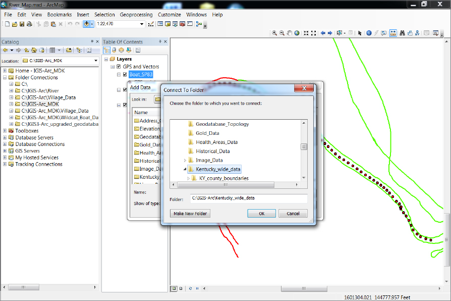
____ 39. Load as a layer the arc component of the CNTY_BND_SPN coverage from
[___]IGIS-Arc\Kentucky_wide_data\KY_county_boundaries.
Make its symbol a black line of width 2. How would you describe the boundary between Fayette and Madison counties with the course of the Kentucky River. ______________________________.
____ 40. Load as a layer the polygon component of the CNTY_BND_SPN coverage from
[__]IGIS-Arc\Kentucky_wide_data\KY_county_boundaries.
By right-clicking the color patch of the layer, make its color Yucca Yellow. The yellow areas of the screen now consist of polygons that represent counties. Use the Identify tool to determine the name of the Area Development District (ADDNAME) that Fayette County is in. (If this doesn’t work at first, you probably didn’t change the layer that the Identify tool looks at to cnty_bnd_spn polygon. Try again.) _____________________ What State Plane (SP_ZONE) zone is it in? _____________ What is the name of the county that you see to the east of Fayette? _______________. ...
Get Introducing Geographic Information Systems with ArcGIS: A Workbook Approach to Learning GIS, 3rd Edition now with the O’Reilly learning platform.
O’Reilly members experience books, live events, courses curated by job role, and more from O’Reilly and nearly 200 top publishers.

