Validating Topology
____ 9. Since we will only need the one rule, you may press Next after you examine the New Topology window. Read through the Summary and, if correct, click Finish. You get a message that the new topology has been created, and are asked if you want to validate it. Say Yes.
In this case validation means that the computer has looked at every point in the Fire_Hydrants feature class to see if a line from Water_Lines comes to it, crosses it, or comes within 5 feet of it. Those points that do not meet these criteria will be flagged as errors. For those cases where the water line is within 5 feet but does not touch the hydrant, the water line will be moved so that it does touch the hydrant.
____ 10. Once validation is complete, the Hydrants dataset will contain an entry labeled Hydrants_Topology. Click it in the T/C and preview its Geography. You should see two red squares. This means that two fire hydrants were not within the cluster distance of a water line segment.
Let’s use ArcMap so we can look at all three layers at once to see what’s going on. See Figure 4-25 for a preview of what you will see in ArcMap.
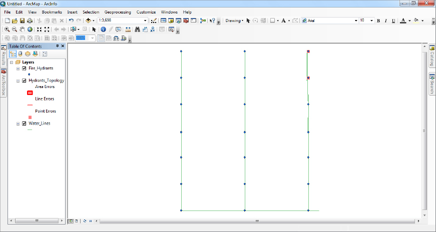
____ 11. Launch ArcMap with a Blank Map. Add Fire_Hydrants to the map. Now add Water_Lines. Observe the map. Finally, add Hydrants_Topology. (You will be asked if you want to add all the feature classes that participate in the topology; since ...
Get Introducing Geographic Information Systems with ArcGIS: A Workbook Approach to Learning GIS, 3rd Edition now with the O’Reilly learning platform.
O’Reilly members experience books, live events, courses curated by job role, and more from O’Reilly and nearly 200 top publishers.

