Labeling Features
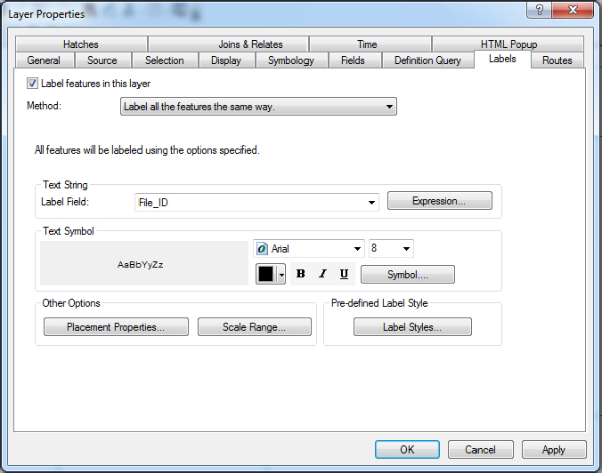
____ 9. Start ArcMap from ArcCatalog, choosing a Blank Map. Dismiss ArcCatalog. Add the feature class TextToFeature_Lines. (Since we didn’t define a spatial reference a warning will appear. Ignore it.) Right-click the feature class name in the T/C and choose Properties.7 Pick the Labels tab. As the Text string Label Field, choose File_ID. If necessary place a check in the box Label Features in this layer. Your Layer Properties window should look like Figure 4-18. Click Apply, then OK.
____ 10. Your map should now look like Figure 4-19. The lines will have the identification numbers that you provided in the text file—that is, 101, 102, and 103. But you notice something peculiar: labels 101 and 102 seem to be on the same line. Well, they aren’t. There are two lines there: one belonging to the leftmost polygon and the other belonging to the adjacent polygon. ArcMap is bright enough not to put one label on top of another, but not bright enough to differentiate one line from the other. Use the Identify tool to determine which line is which. (Hint: Click on a line other than the vertical line. In moving the Identify window around and then zooming to the layer, ArcMap may move the labels so they make more sense—but it also might not.)
FIGURE 4-19 TextToFeature_Lines with lines identified
Now you might be thinking, “Isn’t having two identical lines ...
Get Introducing Geographic Information Systems with ArcGIS: A Workbook Approach to Learning GIS, 3rd Edition now with the O’Reilly learning platform.
O’Reilly members experience books, live events, courses curated by job role, and more from O’Reilly and nearly 200 top publishers.

