Nested Polygons in Geodatabases
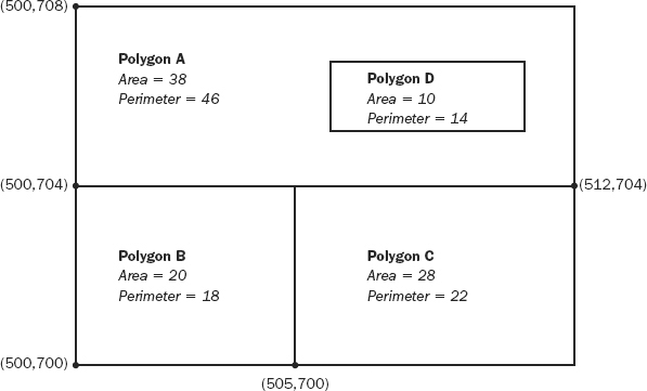
It is important to look at the calculations of plane area (called Shape_Area) and perimeter (called Shape_Length) for nested geodatabase polygons. Look at Figure 4-13, which has an island polygon D that has dimensions of 2 units by 5 units. Be sure you understand the area and perimeter calculations of polygon A, particularly with regard to the Shape_Area and Shape_Length.
FIGURE 4-13 A simple topological diagram in geodatabase form
Get Introducing Geographic Information Systems with ArcGIS: A Workbook Approach to Learning GIS, 3rd Edition now with the O’Reilly learning platform.
O’Reilly members experience books, live events, courses curated by job role, and more from O’Reilly and nearly 200 top publishers.

