Rasters of Land Cover Data
Of considerable interest to urban and regional planners is what is called “land cover” (or the allied but somewhat different concept of “land use”): the vegetation, water, natural surface, human activity on the land surface, and so on. In the following, you will load a data set that describes land cover in Fayette County Kentucky at a high-level of resolution.
____ 12. Load as a layer fyttelc06alii, which is a raster, you can find in [___]IGIS-Arc\Kentucky_wide_data. If asked, do not build pyramids. Turn all other image and polygon layers off. Zoom to the full extent of the data set to get an idea of the amount of data. Zoom to the GPS track. See Figure 2-41. Based on the color of the cells and looking at the legend, what would you say the code for open water is? ______. What is the code cultivated crops? _______. Verify each of these using the Identify tool. Zoom further in so that you can measure the width of a cell. What are the dimensions of the cells in this data set? _____________ feet. Which is __________ meters. How much area in each? ____________ square feet. An acre would contain how many cells? ____________. As I said, this is a high-resolution data set.
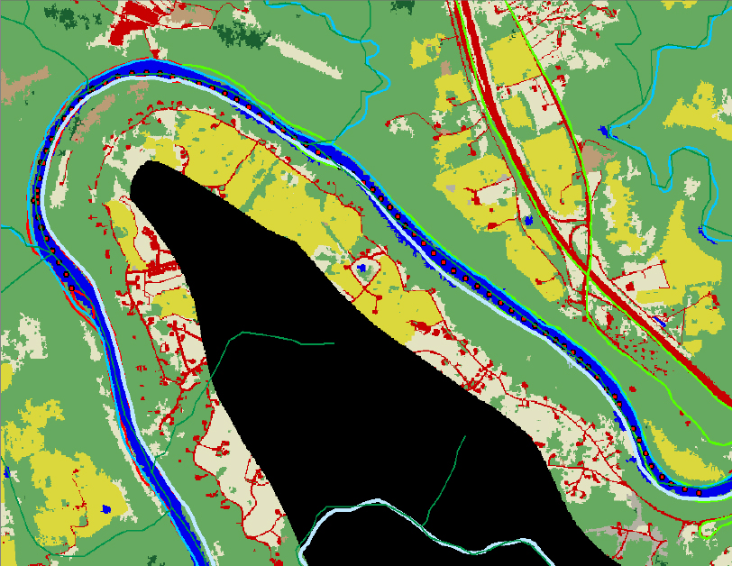
____ 13. Open the attribute table of fyttelc06alii. Based on the value of Count, how many cells represent open water? __________. Therefore, how many square miles of water ...
Get Introducing Geographic Information Systems with ArcGIS: A Workbook Approach to Learning GIS, 3rd Edition now with the O’Reilly learning platform.
O’Reilly members experience books, live events, courses curated by job role, and more from O’Reilly and nearly 200 top publishers.

