MapServer
MapServer is the primary open source web mapping tool used in this book. The main MapServer site is at http://mapserver.gis.umn.edu.
There are numerous reasons people decide to use MapServer. One is the ability to make their mapping information broadly accessible to others, particularly over the Internet. Many GIS and mapping analysts need to create custom mapping products for those they support or work for; MapServer makes it possible for users to create maps without needing particular tools installed or assistance from mapping analysts. This in turn reduces the pressure on specialized staff.
Others come to MapServer because it is one of few solutions available for those with diverse data formats. MapServer, through the use of libraries such as GDAL/OGR, can access various data formats without data conversion.
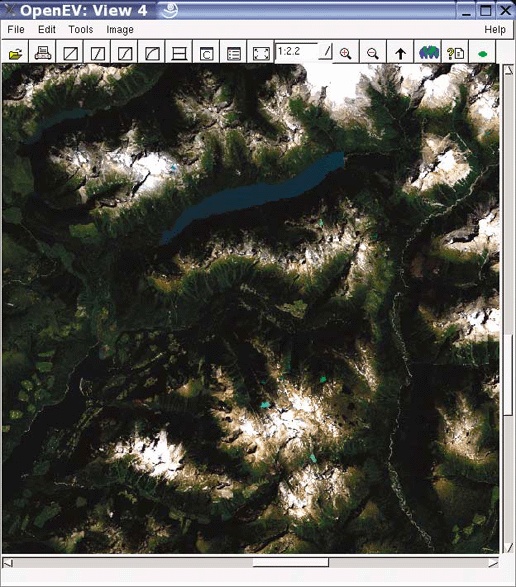
Figure 3-1. A raw Landsat satellite image being viewed with OpenEV
Consider that you could have a collection of 10 different sets of mapping data, all of which need to appear on the same map simultaneously without any of the data being converted from its native format. The native formats can include those used by different commercial vendors. ESRI shapefiles, Intergraph Microstation design files (DGN), MapInfo TAB files, and Oracle spatial databases can all be mapped together without conversion. Other nonproprietary formats can be used as well, including the OGC standards ...
Get Web Mapping Illustrated now with the O’Reilly learning platform.
O’Reilly members experience books, live events, courses curated by job role, and more from O’Reilly and nearly 200 top publishers.

